Vicksburg ghost town Sawatch Range Ceramic Art Tile
— the cabins the silver left behind.
Not only on a wall.


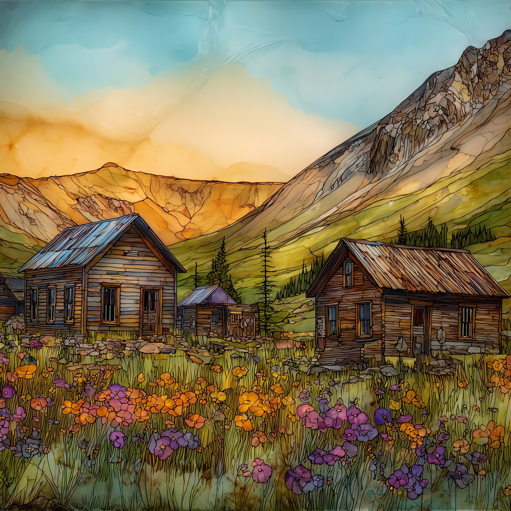
“A ghost town in Clear Creek Canyon, west of Granite, Colorado, where the Sawatch Range begins to rise. The cottonwoods along the main road were planted by miners in the 1880s. They outlived the silver boom by more than a century, and they shade the empty cabins now. The Missouri Gulch trailhead a half mile up the road sends climbers toward three fourteeners. Past Vicksburg the canyon narrows toward Winfield, another ghost town, and snow closes the road from late October through May. Climbers from Missouri Gulch often stop here on the way down. The cottonwoods catch the wind.

Vicksburg ghost town Sawatch Range Ceramic Art Tile, on ceramic.
Each tile is finished by hand in our Knoxville studio. Artwork is slowly infused into the ceramic surface under high heat and pressure, and rests beneath a thin glossy finish. The colour lives in the surface, not on top of it.
Pick any four 4-inch tiles — National Parks you've been to, a Smokies set, the four seasons of one place. $ for a set of , cork-backed, ready to live on the table.

Each tile ships in a kraft box, tied with cream ribbon, with a handwritten note from the studio if you'd like to add one.

Three or five different vistas, hung together — a chapter of places you've been, or want to go.
The place, in three passes.
Vicksburg sits at roughly 9,700 feet in Clear Creek Canyon, on the eastern slope of Colorado's Sawatch Range. It lies along Chaffee County Road 390, which threads three former silver camps between US-24 and the back of the range: Beaver City, Vicksburg, and Winfield. The town was platted in 1881 during the Colorado silver boom and reached a peak population near 600 before the silver crash of 1893 emptied it. The cottonwood trees lining the main road were planted by the original settlers and have outlasted the town by more than a century, still shading the surviving log cabins. A small seasonal museum holds artifacts of the silver era under volunteer keepers, and the surrounding land is administered as part of San Isabel National Forest.
On most days from June through September the canyon carries one sound at a time. Wind through the cottonwoods. Clear Creek over its bed. A pickup heading up toward Missouri Gulch. The last permanent residents left Vicksburg in the early twentieth century, and the town has been empty since. A few original cabins lean against the slope, and the museum opens on summer afternoons under volunteer keepers. The Sawatch Range above the town reaches above 14,000 feet at Mount Belford and Mount Oxford, so the daytime traffic is climbers and the night belongs to the canyon. The U.S. Forest Service maintains the road and the surrounding land as part of San Isabel National Forest.
Chaffee County Road 390 is the only road into Vicksburg, and it is the limit on when the town can be reached. The road climbs west from US-24 near Granite, Colorado, and it is plowed only as far as the Clear Creek Reservoir in winter. Above that, snow closes the eight miles to Vicksburg from roughly late October through May, depending on the year. The drivable window is late spring through mid-October, with peak access in July, August, and the first half of September, when the cottonwoods turn yellow against the dark conifers of the Sawatch. A high-clearance vehicle is not required to reach Vicksburg itself, though the road past Winfield turns rough.