
Two Buttes reservoir Ceramic Art Tile
— a basin of sky between the buttes.
Not only on a wall.


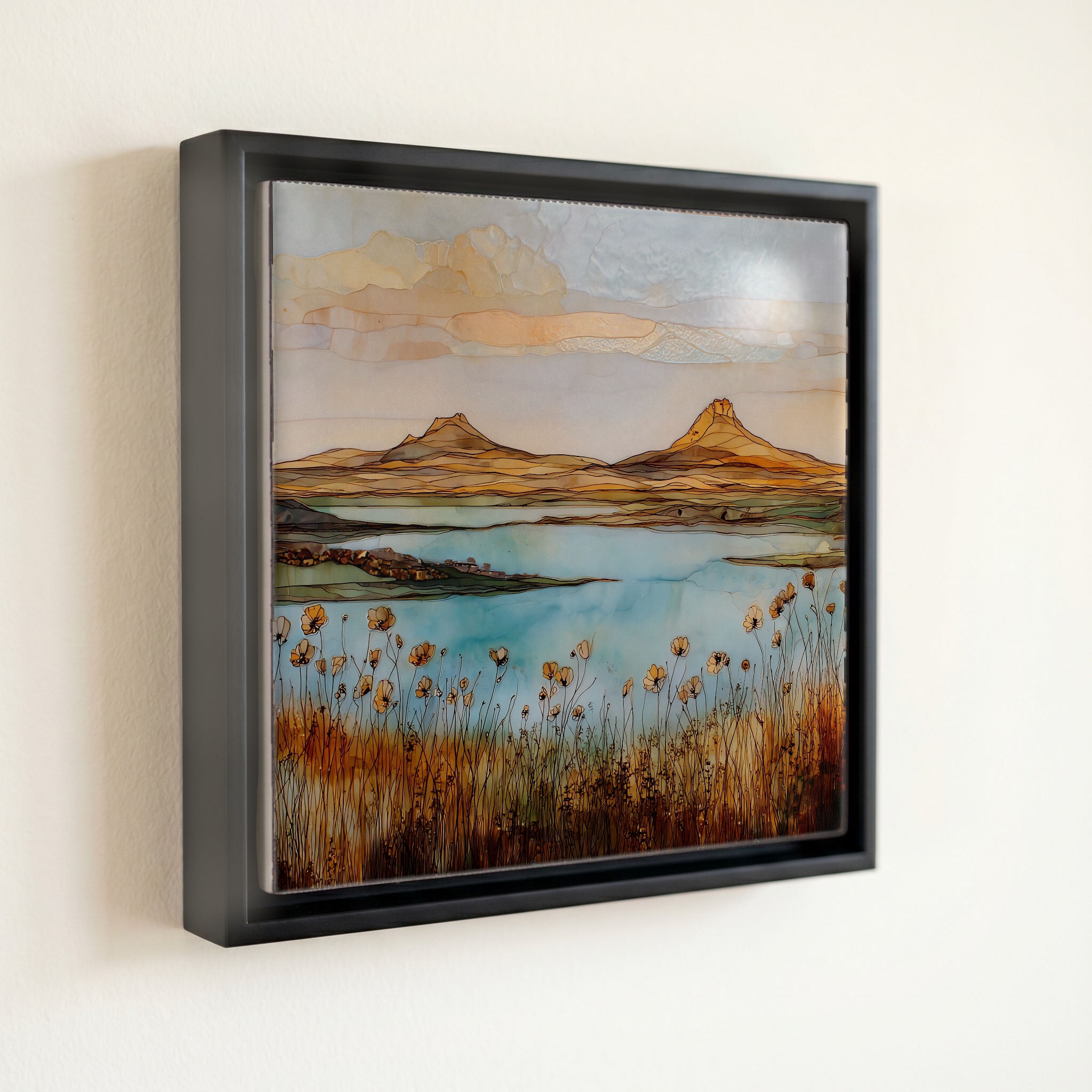
“Twin igneous peaks rising about three hundred feet above an otherwise flat shortgrass prairie, and a reservoir at their foot that comes and goes with the weather. Two Buttes Creek is an intermittent stream, empty most years, then heavy enough after a southeast Colorado storm to fill a half-mile basin behind the dam built in 1910. When the lake is full, anglers from Lamar and Springfield drive in for wiper and channel catfish. When it isn't, the basin reads as cracked clay under a sky that never stops. Both versions of the place are the place.
Two Buttes reservoir Ceramic Art Tile, on ceramic.
Each tile is finished by hand in our Knoxville studio. Artwork is slowly infused into the ceramic surface under high heat and pressure, and rests beneath a thin glossy finish. The colour lives in the surface, not on top of it.
Pick any four 4-inch tiles — National Parks you've been to, a Smokies set, the four seasons of one place. $ for a set of , cork-backed, ready to live on the table.

Each tile ships in a kraft box, tied with cream ribbon, with a handwritten note from the studio if you'd like to add one.

Three or five different vistas, hung together — a chapter of places you've been, or want to go.
The place, in three passes.
Two Buttes Reservoir sits on the high shortgrass prairie of Baca County, in southeastern Colorado, about 15 miles north of Springfield and 31 miles south of Lamar, east of US Routes 287/385. The wildlife area takes its name from the twin volcanic peaks rising about 300 feet above the surrounding plains, just north across the Prowers County line. The reservoir was built between 1909 and 1910 by the Two Buttes Irrigation and Reservoir Company under engineer Fred Harris, on Two Buttes Creek, an intermittent stream fed only by storm runoff. Colorado Parks and Wildlife has administered the property as a State Wildlife Area since 1970, and access requires a SWA pass or a valid hunting or fishing license for anyone 16 or older.
The two peaks above the reservoir are a late Miocene laccolith of andesite porphyry that pushed up through older Triassic and Jurassic sandstone caps and then spread out under them. The result is a double-capped formation rising about 400 feet above the Tertiary plains, with the south peak roughly 30 feet higher than the north. The intrusion produced about 800 feet of structural closure in the overlying sediments. At 4,701 feet, the buttes are the highest point in Prowers County and stay visible for miles in every direction across the southeast Colorado tableland, the landmark settlers used to find their way home before the section roads were cut.
Two Buttes Creek is one of the high plains' intermittent streams, dry most of the year and capable of carrying a substantial flood when a thunderstorm tracks across southeast Colorado. The reservoir behind the 1910 dam reflects that rhythm. When water is in the basin, Colorado Parks and Wildlife has counted it among the state's stronger warmwater fisheries, producing largemouth bass, wiper, saugeye, channel catfish, bluegill, and crappie. In March 2026 the agency rescinded an emergency fish salvage order after the reservoir went completely dry, ending fishing in the main basin for now. Black Hole Pond, the smaller impoundment immediately below the dam, still holds bass, bluegill, channel catfish, and seasonal rainbow trout.