Tundra Communities trail Rocky Mountain National Park Ceramic Art Tile
— — the country above the trees.
Not only on a wall.


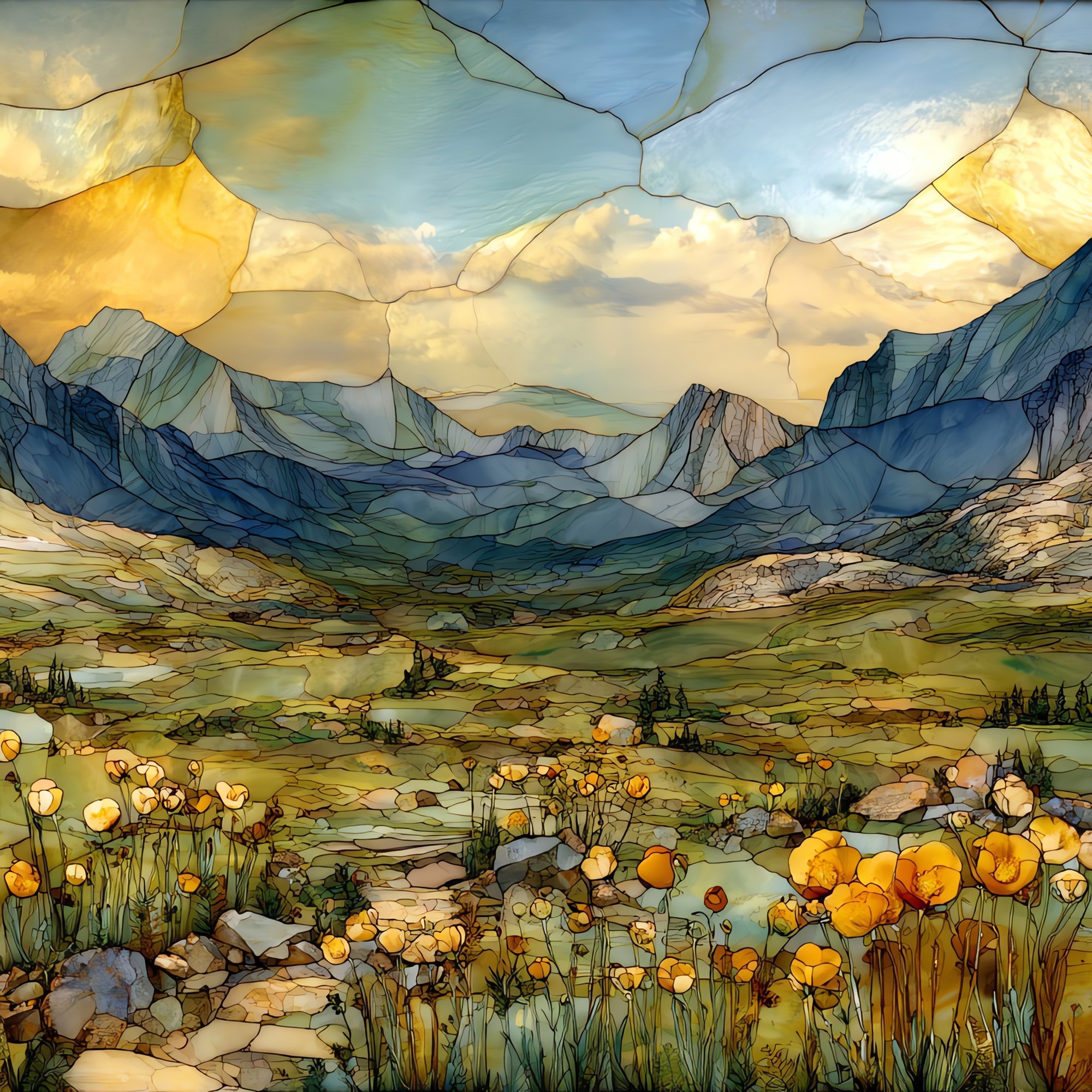
“A paved half-mile that leaves Trail Ridge Road and walks straight into the alpine tundra. The trailhead sits at about 12,110 feet at Rock Cut. The path ends at the Toll Memorial above 12,300 feet, among granite formations the wind and ice have shaped over millennia. In July and August the ground is laced with moss campion, alpine forget-me-not, and the alpine sunflower that grows only in the Rocky Mountains. Pikas call from the rocks. Some of the plants on the path are older than the road itself. A walk to take slowly.

Tundra Communities trail Rocky Mountain National Park Ceramic Art Tile, on ceramic.
Each tile is finished by hand in our Knoxville studio. Artwork is slowly infused into the ceramic surface under high heat and pressure, and rests beneath a thin glossy finish. The colour lives in the surface, not on top of it.
Pick any four 4-inch tiles — National Parks you've been to, a Smokies set, the four seasons of one place. $ for a set of , cork-backed, ready to live on the table.

Each tile ships in a kraft box, tied with cream ribbon, with a handwritten note from the studio if you'd like to add one.

Three or five different vistas, hung together — a chapter of places you've been, or want to go.
The place, in three passes.
Rocky Mountain National Park sits in north-central Colorado, straddling the Continental Divide between Estes Park and Grand Lake. The Tundra Communities Trail begins at the Rock Cut pullout on Trail Ridge Road, which climbs to 12,183 feet and is the highest continuous paved road in the United States. From the trailhead at about 12,110 feet, the paved half-mile walk gains roughly two hundred feet to the Toll Memorial, named for Roger W. Toll, park superintendent from 1921 to 1929. The trailhead is 4.1 miles east of the Alpine Visitor Center and 12.9 miles west of Deer Ridge Junction, in the band of the park where forest gives way to open tundra.
The trail walks through alpine tundra, the band of life above the treeline, which in Colorado's Front Range sits near 11,500 feet. Up here there is roughly forty percent less oxygen than at sea level, no shade, and weather that changes in minutes. Afternoon thunderstorms build almost daily in summer and bring lightning that is the single largest hazard on the exposed ridge. Tundra plants survive by staying low and growing slowly. Many species form dense cushions only a few inches across; some take a century to reach the size of a coffee saucer. Repeated footsteps strip the thin soil away, and recovery can take centuries, which is why the trail is paved and the rangers are firm about staying on it.
Trail Ridge Road typically opens around Memorial Day and closes by mid-October, leaving roughly a five-month window each year for visitors to reach the Tundra Communities trailhead. Inside that window the alpine spring runs late. The first wildflowers appear in late June and peak through July and early August, when alpine avens turn the slopes yellow and moss campion blooms pink. Snow can fall in any month at this elevation, and the National Park Service notes that even summer mornings often start below freezing. Late August into September brings the alpine sunflower's seed heads and the season's clearest weather. The road usually closes for winter after the first significant October storm and stays closed until plows reopen it the following spring.