Mount of the Holy Cross snow cross Sawatch Range Ceramic Art Tile
— — the cross the snow holds into July.
Not only on a wall.


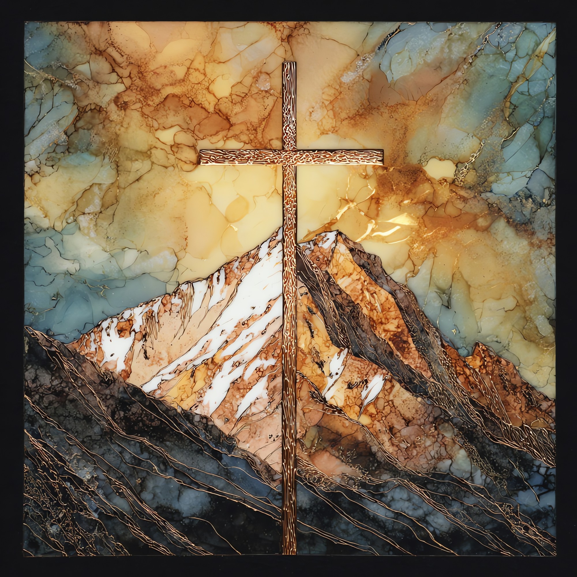
“A fourteen-thousand-foot peak in the Sawatch Range, west of the Continental Divide. On the northeast face two couloirs cross. The vertical arm runs roughly 1,500 feet and the horizontal somewhere near 750, and the snow holds the figure into July. William Henry Jackson photographed it for the Hayden Survey in 1873; the print travelled, and a country that needed a sign found one. Longfellow wrote his sonnet six years later. The right arm has eroded since, and the snow keeps less of the line, but it still keeps enough.

Mount of the Holy Cross snow cross Sawatch Range Ceramic Art Tile, on ceramic.
Each tile is finished by hand in our Knoxville studio. Artwork is slowly infused into the ceramic surface under high heat and pressure, and rests beneath a thin glossy finish. The colour lives in the surface, not on top of it.
Pick any four 4-inch tiles — National Parks you've been to, a Smokies set, the four seasons of one place. $ for a set of , cork-backed, ready to live on the table.

Each tile ships in a kraft box, tied with cream ribbon, with a handwritten note from the studio if you'd like to add one.

Three or five different vistas, hung together — a chapter of places you've been, or want to go.
The place, in three passes.
Mount of the Holy Cross stands at 14,011 feet in the Sawatch Range of central Colorado, inside the Holy Cross Wilderness of the White River National Forest. Eagle County contains it; the nearest towns are Minturn and Red Cliff, both within fifteen miles to the east. The peak is reached most commonly from the Half Moon trailhead at the end of Tigiwon Road, with the standard route climbing the north ridge over Half Moon Pass. The classic vantage for the cross itself is Notch Mountain, across the valley to the east, where a 1924 stone shelter at 13,077 feet looks straight at the northeast face.
The cross appears as two intersecting snow couloirs on the northeast face. The vertical arm runs roughly 1,500 feet long, the horizontal arm about 750 feet, and the figure is most legible from late May through mid-July, when the spring snowpack has set and summer melt has not yet reached the upper face. By August the right arm has usually thinned past recognition; by the first October storms the cross returns. The right arm has also eroded geologically over the past century: a rockslide and the gradual deepening of the gully have shortened it, which the Department of the Interior cited when it stripped the site of its 1929 National Monument designation in 1950.
The Holy Cross Wilderness covers 122,797 acres of the Sawatch Range, designated by Congress in 1980. The Notch Mountain Trail, which pilgrims took by the tens of thousands between 1912 and the 1930s, climbs to a stone shelter built by the Forest Service in 1924. The shelter still stands and is open to the public. The pilgrimages ended after the Second World War, partly because the right arm of the cross had begun to fail and partly because the cars that brought the pilgrims now carried them elsewhere. Today most parties on the standard north-ridge route summit before midmorning to be off the exposed ridge by the early-afternoon thunderstorm cycle.