
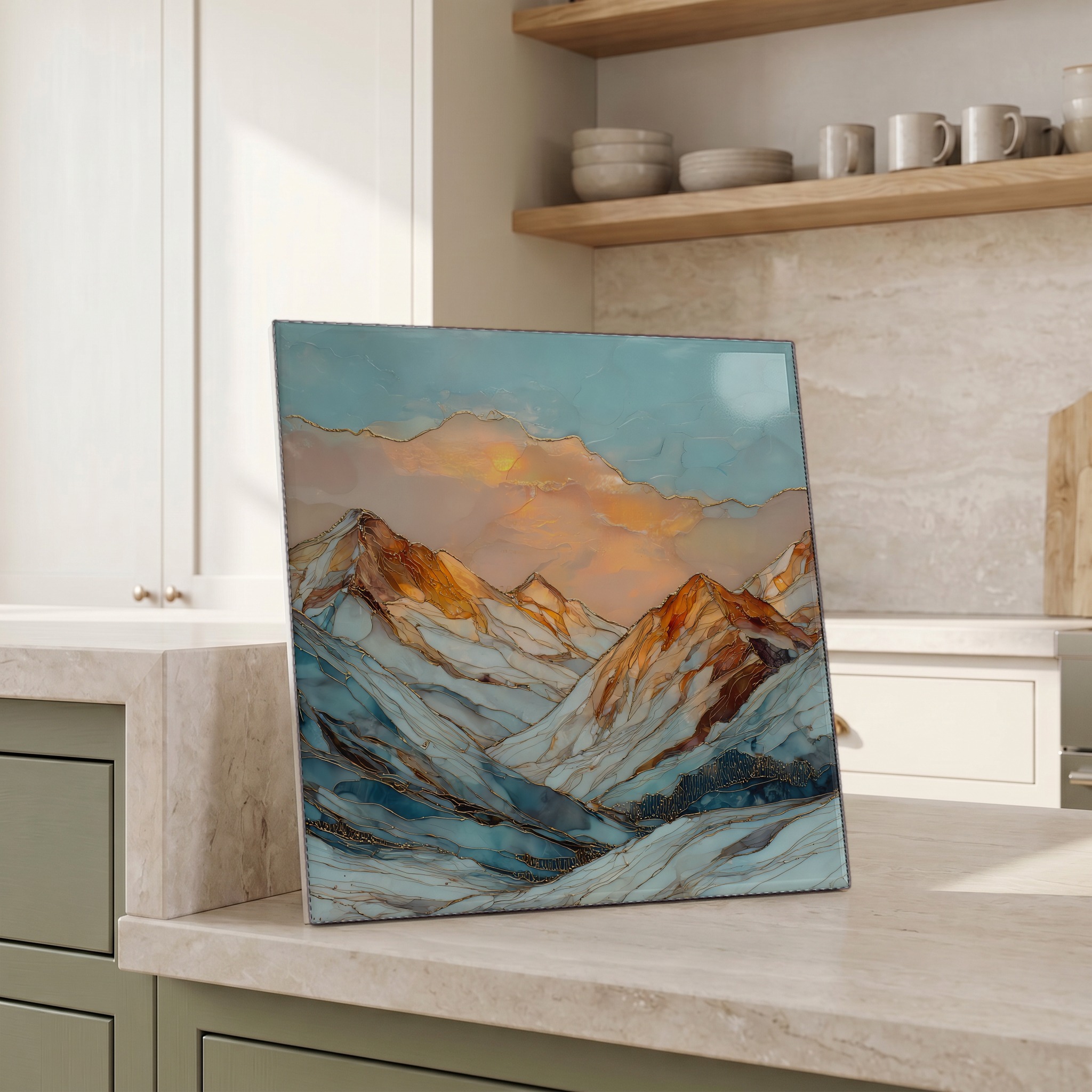
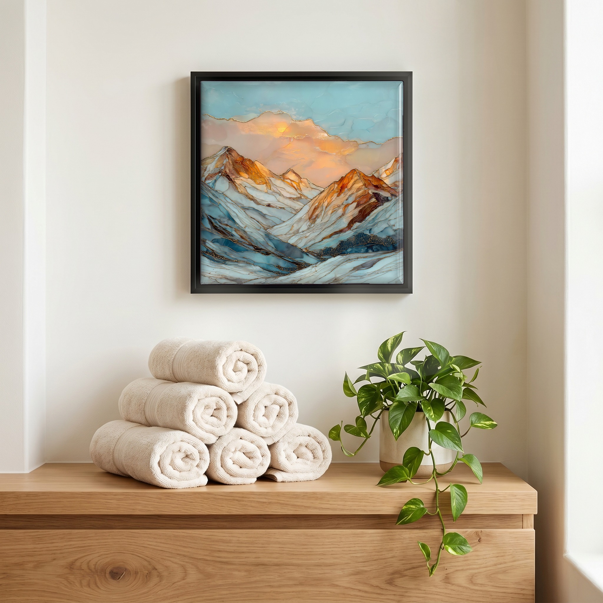
Loveland Pass and ski area Front Range Ceramic Art Tile
— — the road that crosses where the rivers part.
Not only on a wall.


“The highest paved pass in Colorado kept plowed through the winter. U.S. Highway 6 climbs from the Eisenhower Tunnel in a steady 6.7% grade with hairpins on both sides, topping out at 11,990 feet on the Continental Divide. A signed pull-off marks the spot. Snowmelt off the east shoulder runs through Clear Creek toward the Atlantic; off the west shoulder, through the Blue River toward the Gulf of California. Loveland Ski Area sits right there: base at 10,800 feet, the highest base elevation in North America, and lift-served terrain to 12,697 feet on the Ridge. Tankers and propane trucks still climb the pass; backcountry skiers walk the road shoulder up to the spine.
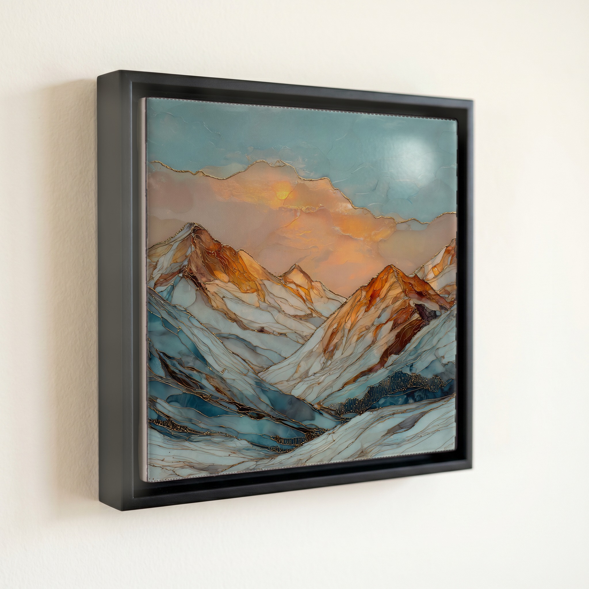
Loveland Pass and ski area Front Range Ceramic Art Tile, on ceramic.
Each tile is finished by hand in our Knoxville studio. Artwork is slowly infused into the ceramic surface under high heat and pressure, and rests beneath a thin glossy finish. The colour lives in the surface, not on top of it.
Pick any four 4-inch tiles — National Parks you've been to, a Smokies set, the four seasons of one place. $ for a set of , cork-backed, ready to live on the table.

Each tile ships in a kraft box, tied with cream ribbon, with a handwritten note from the studio if you'd like to add one.

Three or five different vistas, hung together — a chapter of places you've been, or want to go.
The place, in three passes.
Loveland Pass crests U.S. Highway 6 at 11,990 feet (3,655 m) on the Continental Divide, about 60 miles west of Denver in the Colorado Front Range. The road climbs in a steady 6.7% grade with switchbacks on both sides, straddling the line between Clear Creek and Summit Counties. Below it, the Eisenhower Tunnel carries Interstate 70 traffic through the divide at roughly 11,158 feet, 800 vertical feet beneath the pass. Trucks carrying hazardous cargo or any vehicle over 13 feet 11 inches in height are not permitted in the tunnel and still take U.S. 6 over the pass. The summit pull-off is a signed Continental Divide marker and a launch point for ridgeline routes including Mount Sniktau (13,234 feet) to the northeast.
The pass sits exactly on the Great Divide, the principal watershed line of North America. Rain or snow that falls a few feet east of the summit pull-off drains through Clear Creek into the South Platte and the Missouri, eventually reaching the Atlantic via the Gulf of Mexico. A flake that lands a few feet west crosses into the local Snake River, then into the Blue and Colorado Rivers, on its way toward the Gulf of California. Loveland Ski Area's Chair 9 unloads at 12,697 feet on the same ridge, the third-highest lift-served point in North America. From the summit ridge the eye reads both watersheds at once: east toward Grays Peak at 14,278 feet, west toward the Gore Range.
Loveland Pass is the highest paved mountain pass in Colorado that crews keep plowed through the winter, though closures during heavy storms or avalanche-control work are routine. Loveland Ski Area opens early in the autumn, and most seasons it shares the claim for the first lift-served runs in North America with Arapahoe Basin on the west side of the pass. The lifts run into early May. Summer brings wildflowers along the ridge from late June through August, and the high country is generally clear of snow at the pass by mid-July. Afternoon thunderstorms build quickly above 11,000 feet from June through September; lightning at the summit pull-off is a real hazard.