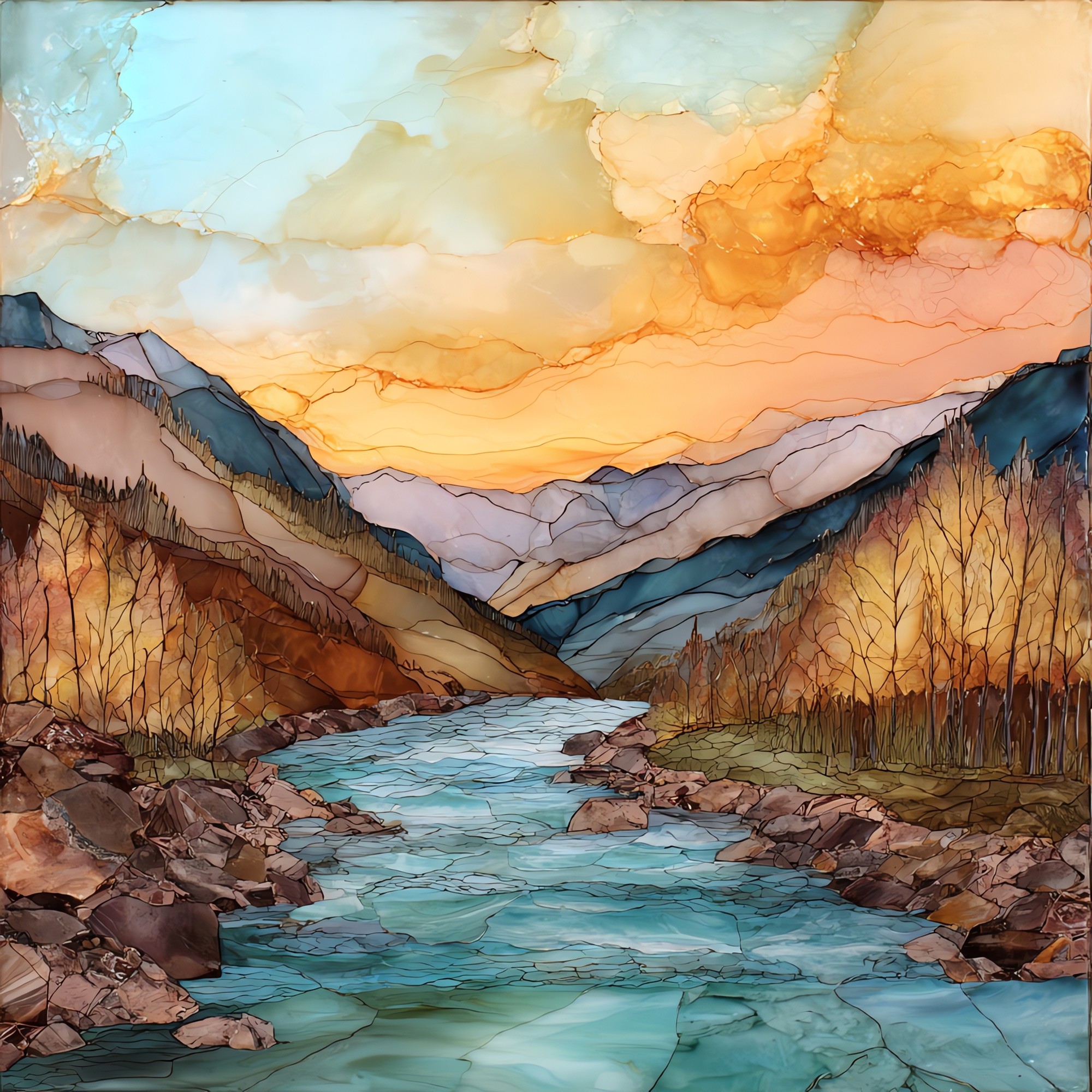
Eagle River at Vail Eagle Valley Ceramic Art Tile
— the green the snow turns into.
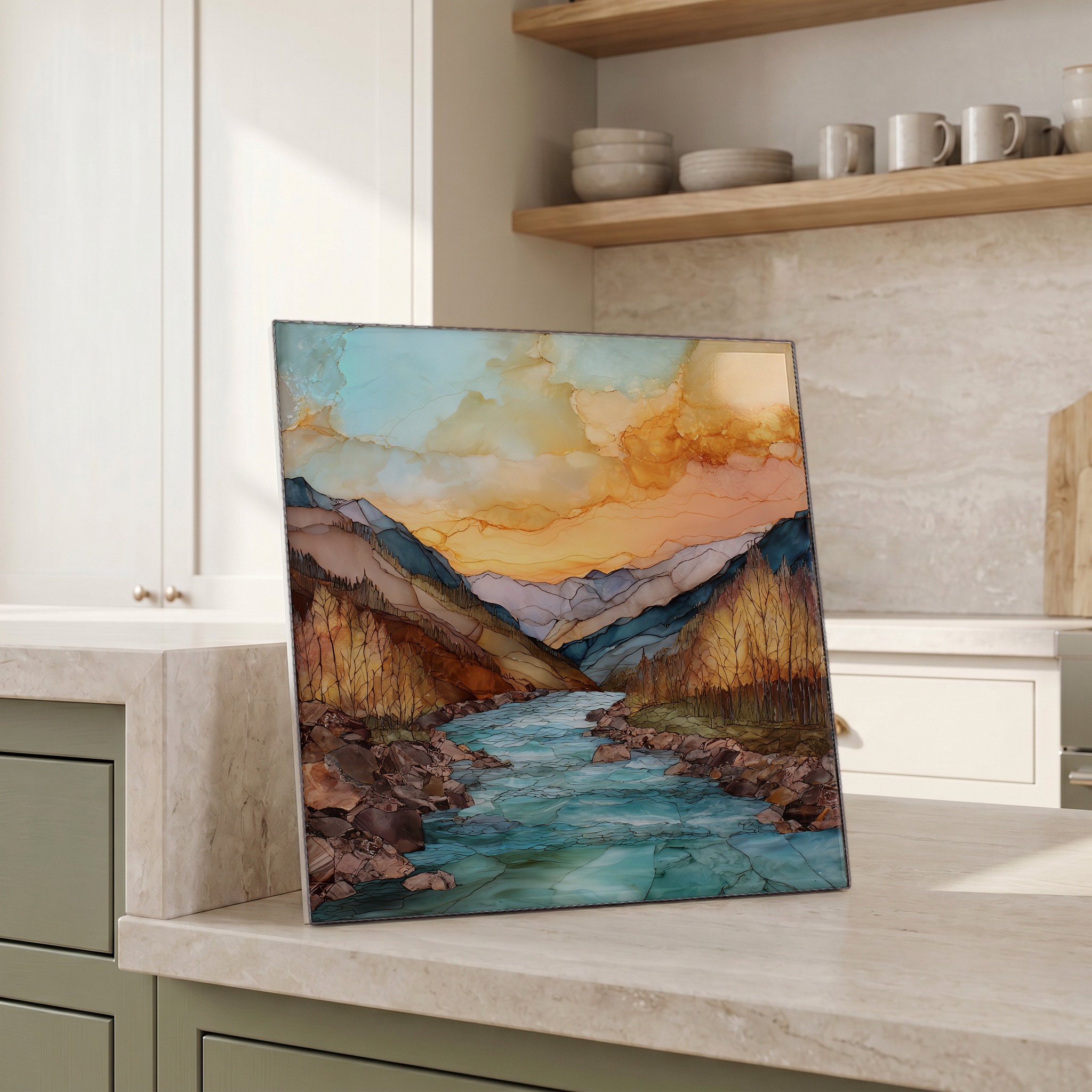
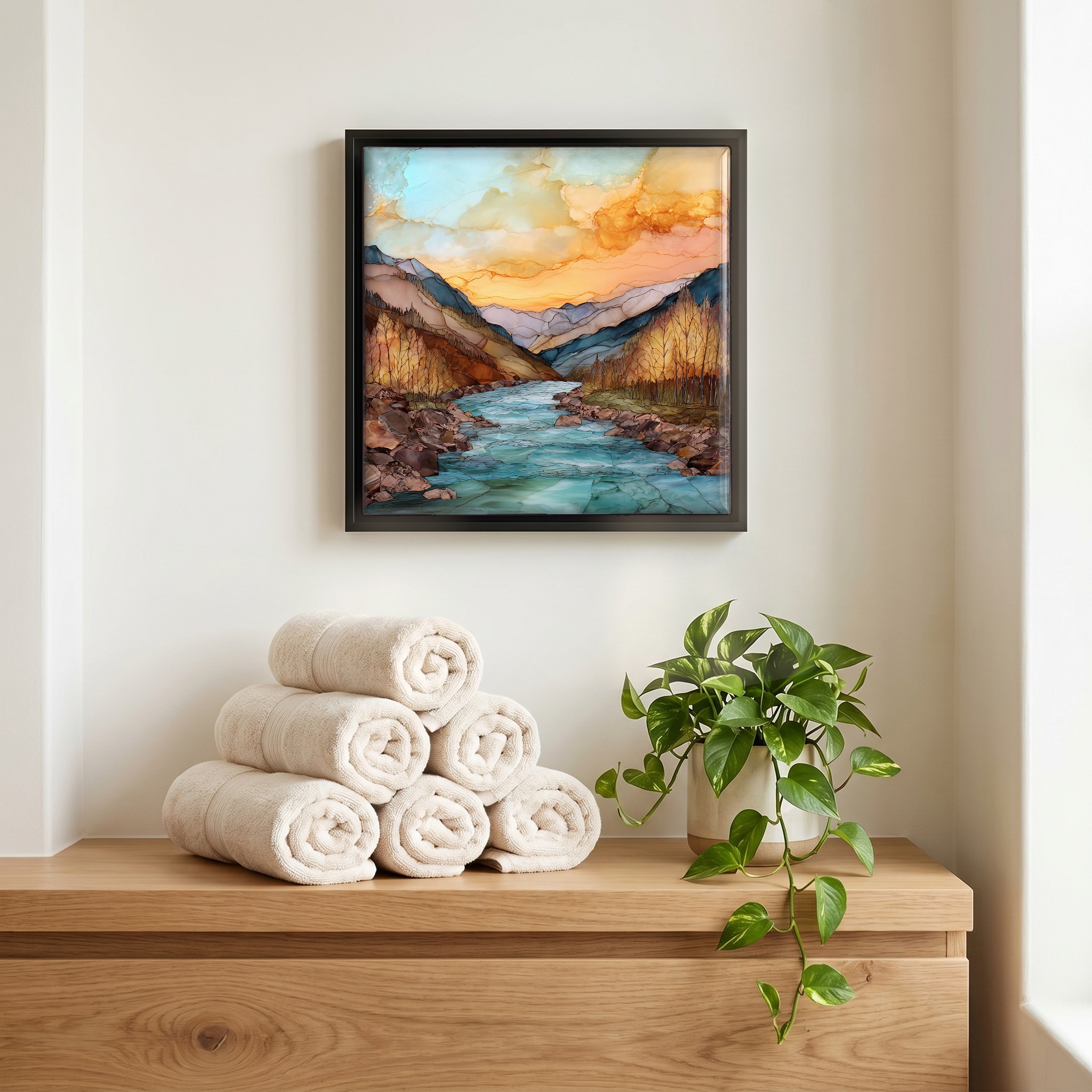
Not only on a wall.


“The Eagle runs the length of the valley it named, west out of Tennessee Pass and down through Minturn and Vail and Avon and Edwards before it gives itself to the Colorado at Dotsero. In Vail Valley it runs alongside Interstate 70 close enough that drivers see it from the road. Cottonwoods on one bank, the Gore Range above. The colour shifts with the snow: silty in June runoff, clear and green by August. Fly rods come out before the heat. The river is colder than the road suggests.
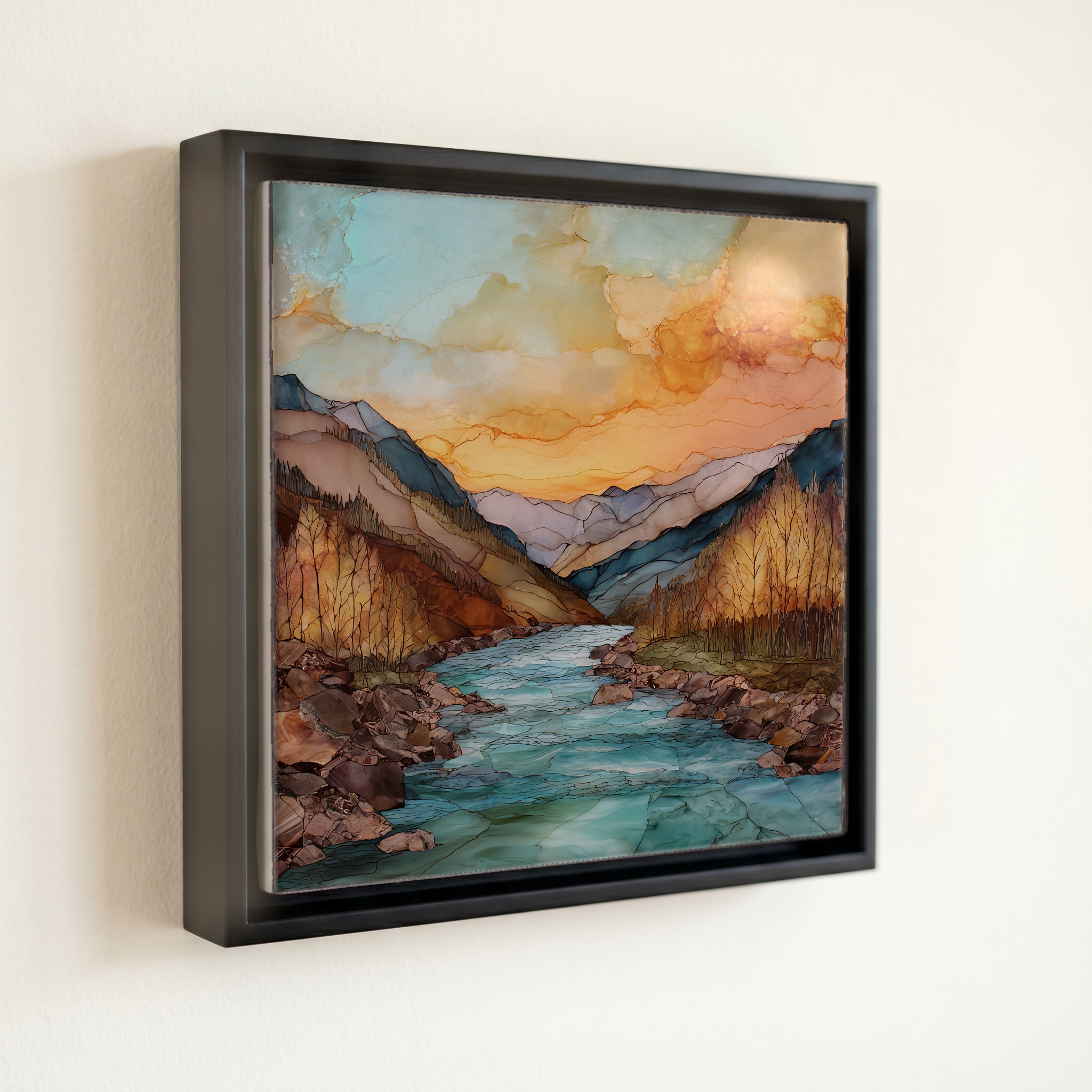
Eagle River at Vail Eagle Valley Ceramic Art Tile, on ceramic.
Each tile is finished by hand in our Knoxville studio. Artwork is slowly infused into the ceramic surface under high heat and pressure, and rests beneath a thin glossy finish. The colour lives in the surface, not on top of it.
Pick any four 4-inch tiles — National Parks you've been to, a Smokies set, the four seasons of one place. $ for a set of , cork-backed, ready to live on the table.
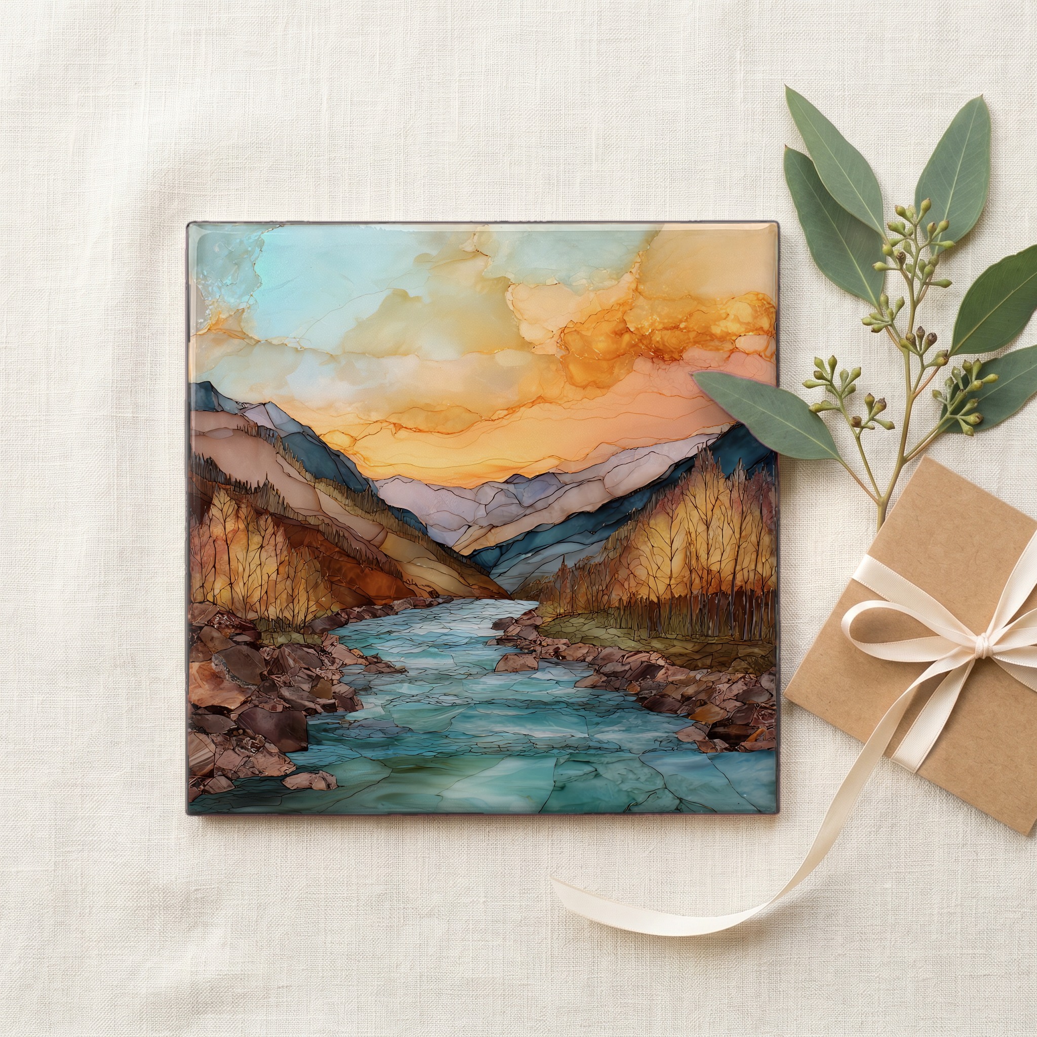
Each tile ships in a kraft box, tied with cream ribbon, with a handwritten note from the studio if you'd like to add one.

Three or five different vistas, hung together — a chapter of places you've been, or want to go.
The place, in three passes.
The Eagle River rises near Tennessee Pass in the Sawatch Range at roughly 10,400 feet, then runs about 70 miles west and northwest through Eagle County, Colorado, before joining the Colorado River at Dotsero. Through Vail Valley it parallels Interstate 70 and the Eagle Valley Trail, passing the town of Vail at 8,150 feet and the smaller communities of Minturn, Avon, Edwards, and Eagle. Above the valley to the north stands the Gore Range; to the south, the Sawatch and the Holy Cross Wilderness. The river drops more than 4,000 feet from headwaters to mouth, a freestone river the whole way.
The Eagle is a freestone river, undammed, fed entirely by snowmelt and tributary creeks rather than a reservoir release. Spring runoff begins in late April and peaks in late May or early June, when the river runs silty and high with melt off the Sawatch and the Gore Range. By midsummer it clears and drops, and the green-blue colour of late summer returns. The river also carries the legacy of mining: the Eagle Mine at Gilman, abandoned in the 1980s, became a Superfund site, and decades of remediation have brought the lower river's water quality back close to where it began.
The fishing window opens after runoff drops in mid-to-late June and runs through October, with the strongest hatches in July and September. Whitewater season is shorter: peak flows for kayaking and rafting fall between Memorial Day and the Fourth of July. The Eagle Valley Trail, a paved path that follows the river from Vail to Eagle, is rideable from spring through late autumn. Winter brings ice along the banks and quiet stretches between the towns. The river never freezes solid through the valley; the current keeps the channel open even on the coldest weeks.