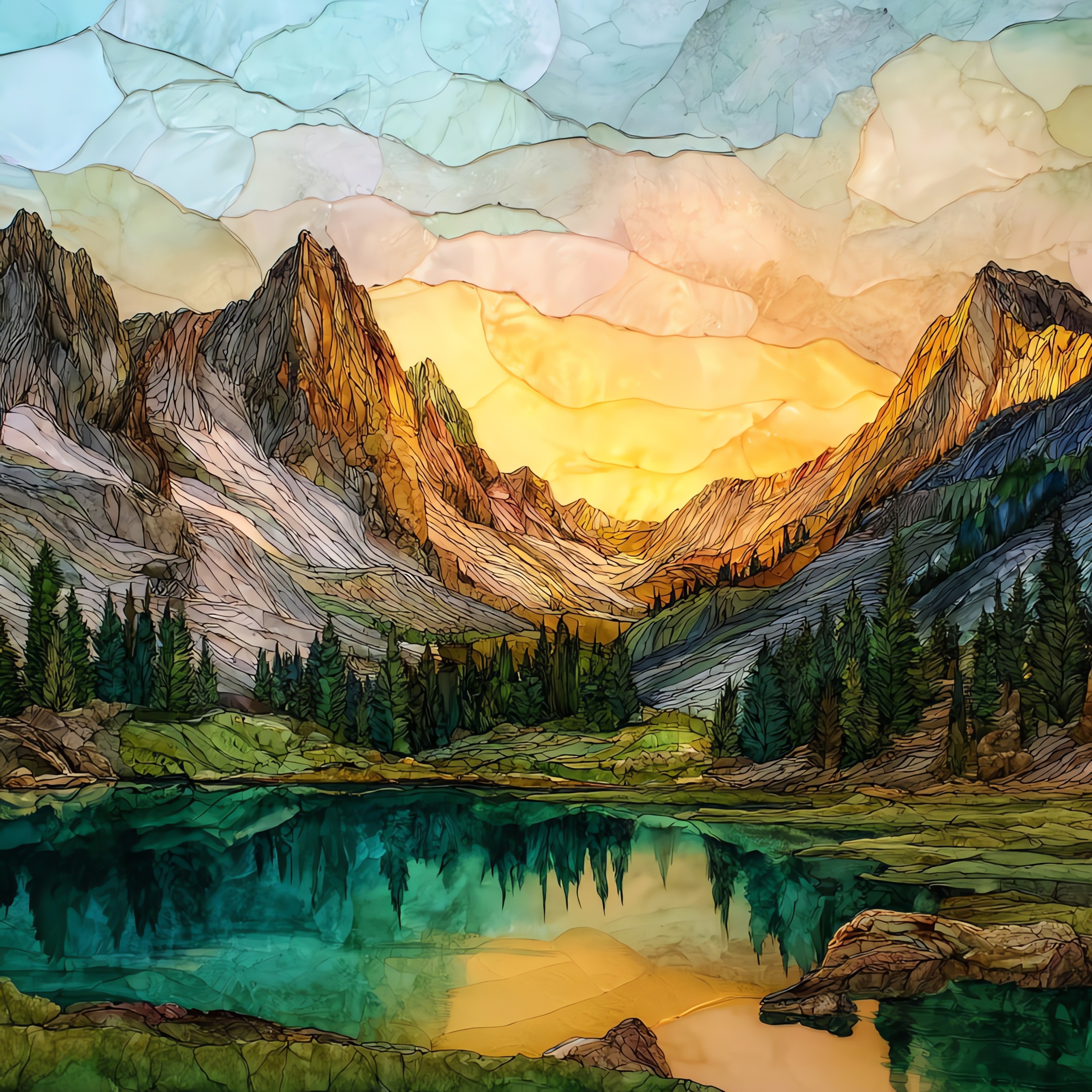
Trinity Alps
— — a range that keeps its own quiet.
Not only on a wall.


“A range of granite peaks and alpine lakes in northwestern California, part of the older Klamath Mountains rather than the Sierra. Thompson Peak rises to roughly 9,000 feet at the center. The 525,000-acre Trinity Alps Wilderness was set aside in 1984 and is one of the largest wilderness areas in the state, threaded with trout-water streams, glacier-carved cirques, and lakes named for their colour: Sapphire, Emerald, Mirror. Anyone driving Highway 3 between Weaverville and Yreka catches the peaks from a long way off; most people pass through and keep going.
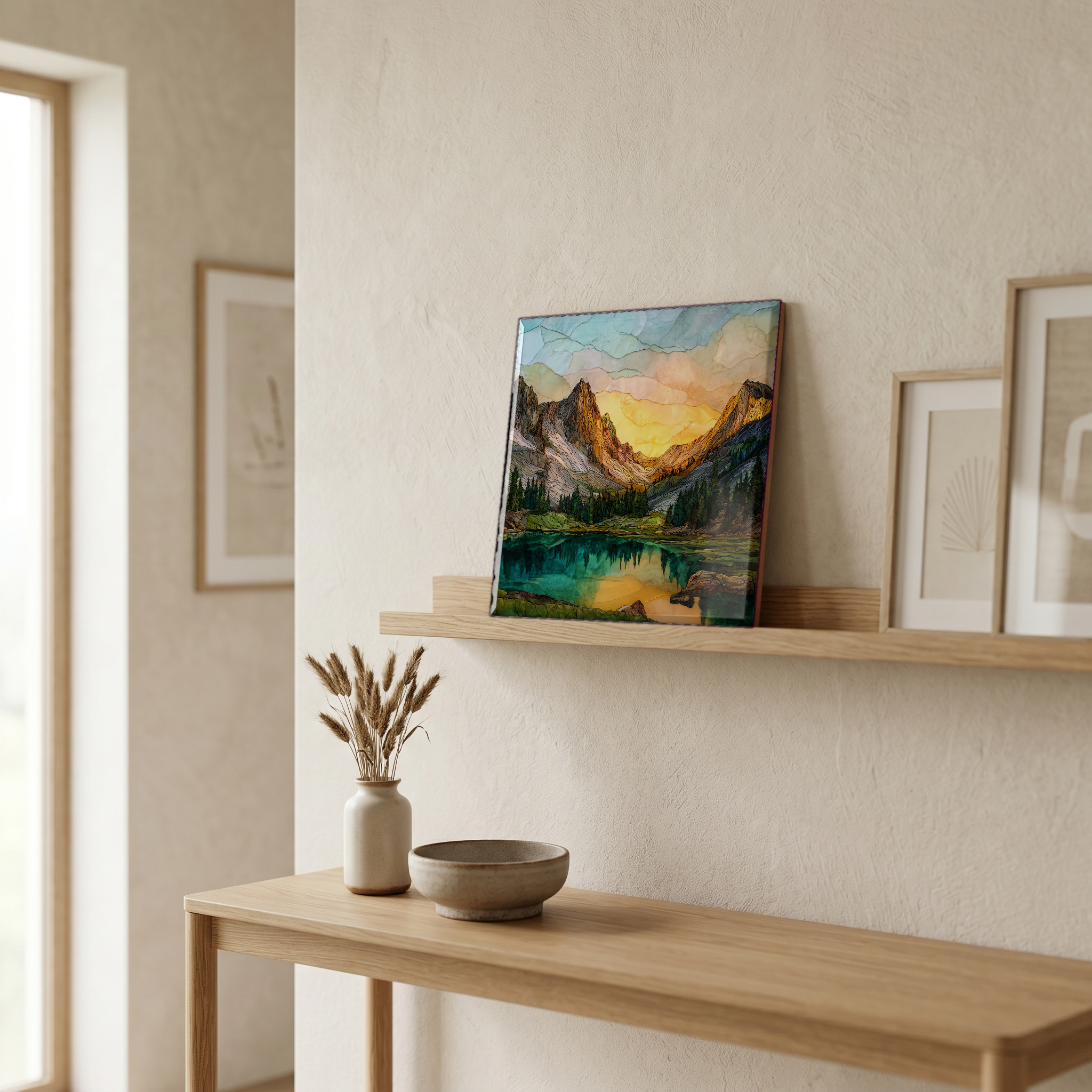
Trinity Alps, on ceramic.
Each tile is finished by hand in our Knoxville studio. Artwork is slowly infused into the ceramic surface under high heat and pressure, and rests beneath a thin glossy finish. The colour lives in the surface, not on top of it.
Pick any four 4-inch tiles — National Parks you've been to, a Smokies set, the four seasons of one place. $ for a set of , cork-backed, ready to live on the table.

Each tile ships in a kraft box, tied with cream ribbon, with a handwritten note from the studio if you'd like to add one.

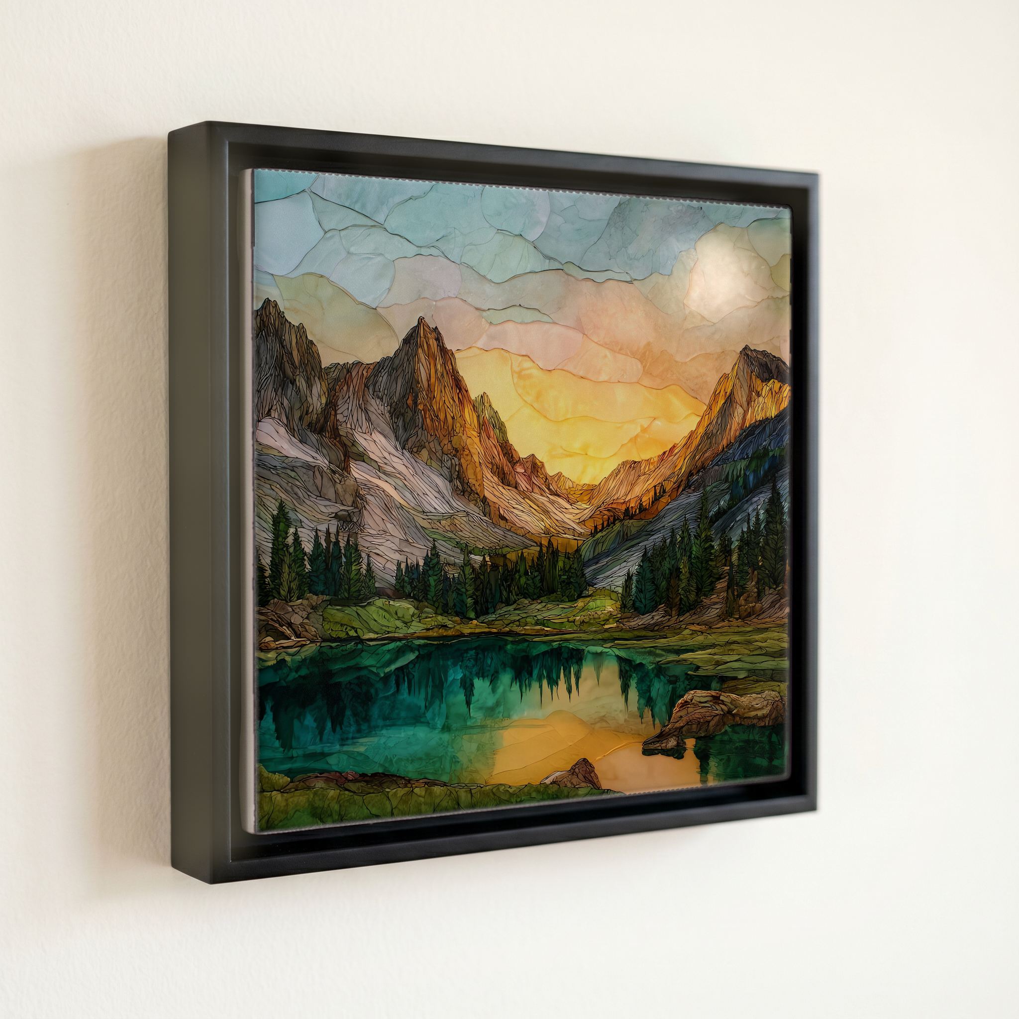
Three or five different vistas, hung together — a chapter of places you've been, or want to go.
The place, in three passes.
The Trinity Alps rise in northwestern California, west of Redding and south of the Oregon border, in the Klamath Mountains rather than the Sierra Nevada. The range is centered on Thompson Peak at roughly 9,002 feet and surrounded by the Trinity Alps Wilderness, designated by Congress in 1984 and covering about 525,000 acres across Trinity, Siskiyou, and Shasta counties. The U.S. Forest Service administers the wilderness as part of the Shasta-Trinity National Forest and adjoining national forests. The Trinity River, the Stuart Fork, and Coffee Creek all rise in the range; the longest trans-Alps trail crosses from Stuart Fork over Mumford Pass and down toward Coffee Creek in roughly 30 miles.
The high core of the Trinity Alps is built on Cretaceous granite intruded into older metamorphic country rock more than 130 million years ago. The Klamath Mountains as a whole are an accreted terrane, a piece of older crust folded onto the western edge of North America, which is why the geology is markedly different from the granite of the Sierra Nevada just east. Glaciers from the Pleistocene sculpted the higher cirques and produced the dozens of small alpine lakes for which the range is known. The U.S. Geological Survey maps the central plutons as part of the Klamath terrane.
The range is reached from the west via Highway 299 through Weaverville, from the east via Highway 3, or from the north via Highway 96 along the Klamath River. The main trailheads (Stuart Fork, Canyon Creek, Big Flat) all sit at the end of Forest Service roads of varying condition. Snow can close the high passes from October into June, and seasonal wildfire closures sometimes affect access during late summer. Day hiking does not require a permit; the Shasta-Trinity National Forest does require a free overnight wilderness permit for camping inside the boundary, available at ranger stations or by self-issue at trailheads.