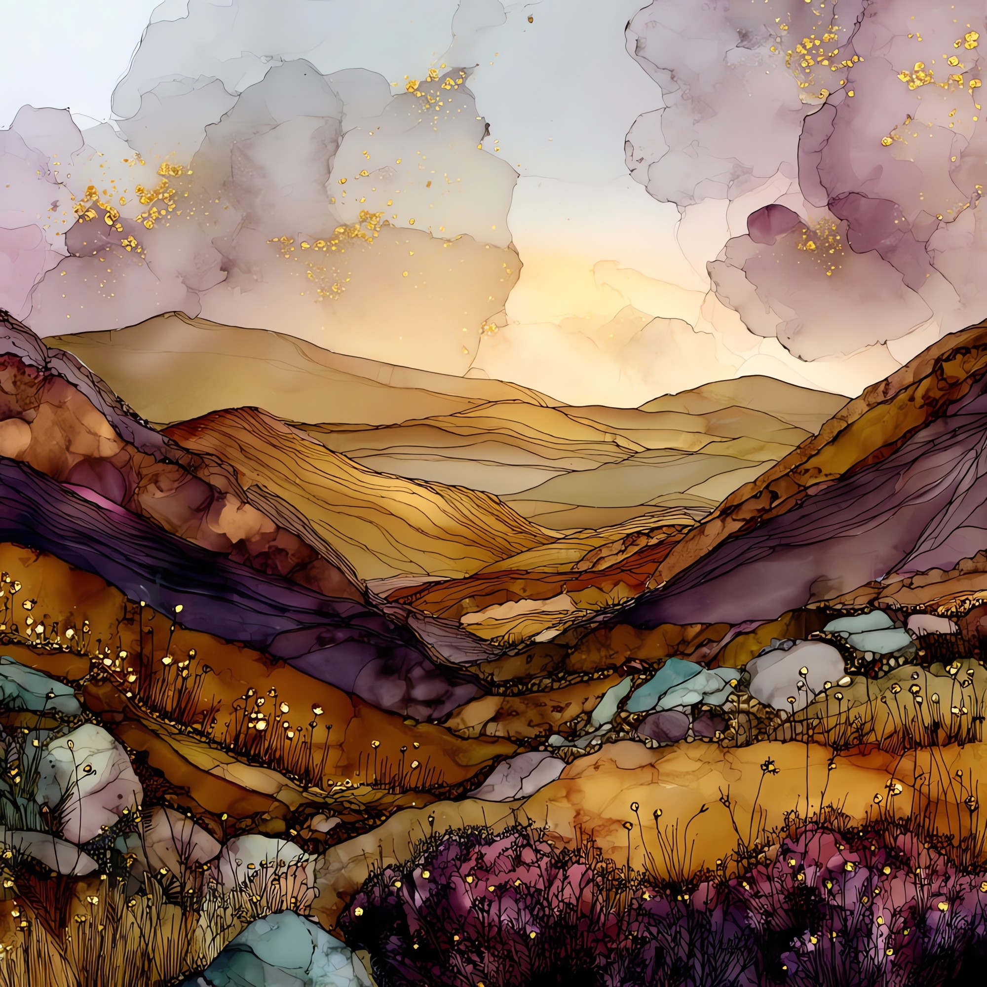
Sperrin Mountains
— — a low brown country, under a high grey sky.
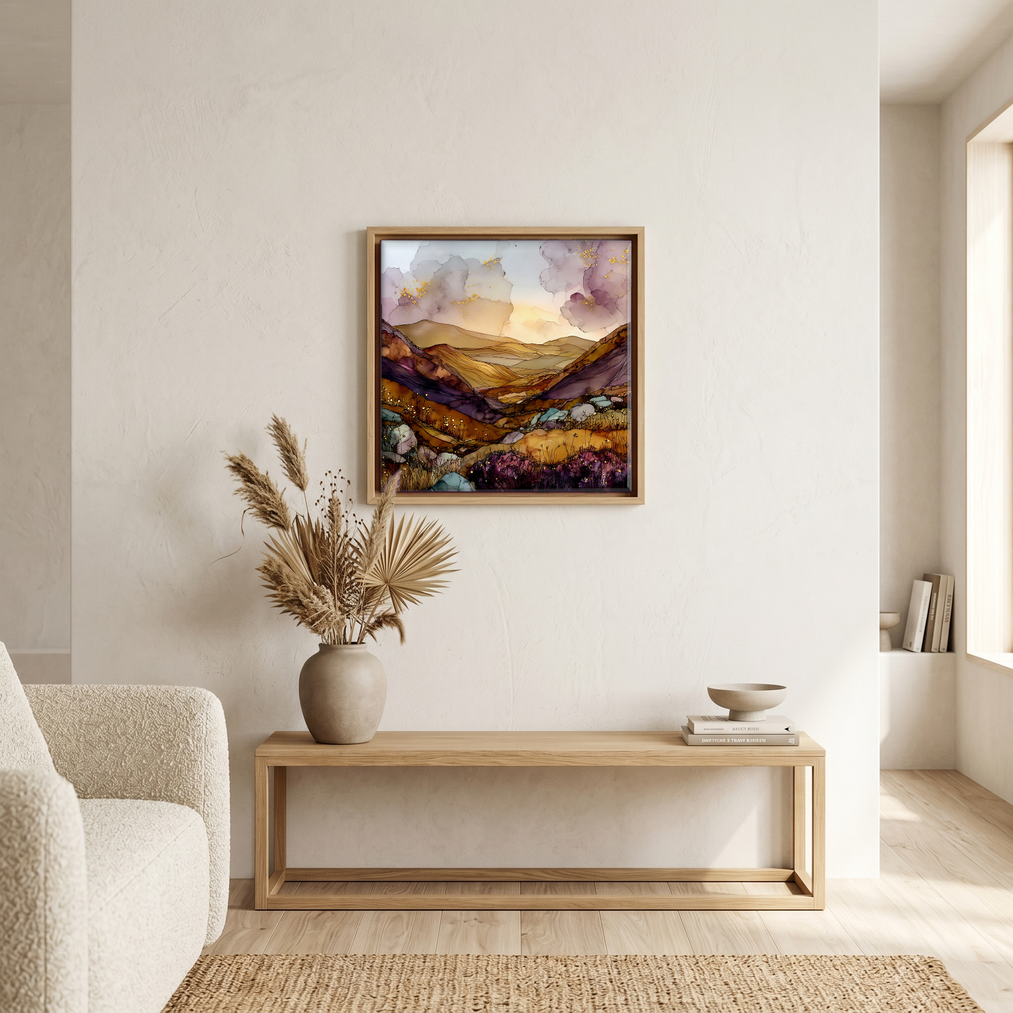
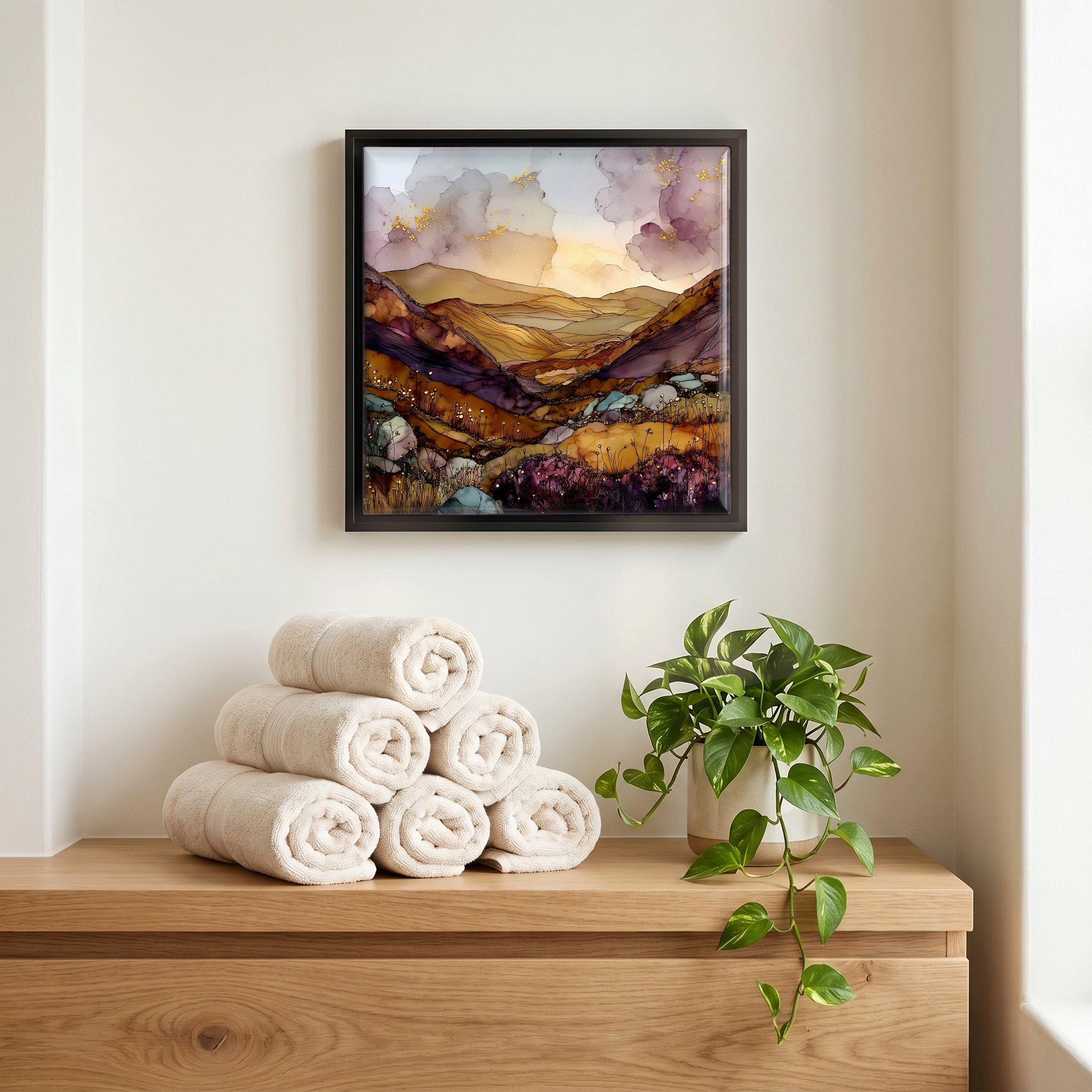
Not only on a wall.
“High moorland in the north of Ireland, rolling from Strabane east to the River Bann. Sawel and Dart at the spine, low and heathered, the kind of upland that doesn't announce itself. Few villages, fewer roads. The Bronze Age left stone circles at Beaghmore, and the glaciers left U-shaped valleys nobody has bothered to flatten. On clear nights, Davagh Forest holds the darkest sky in Northern Ireland. People who know the Sperrins tend to come back quiet about it.
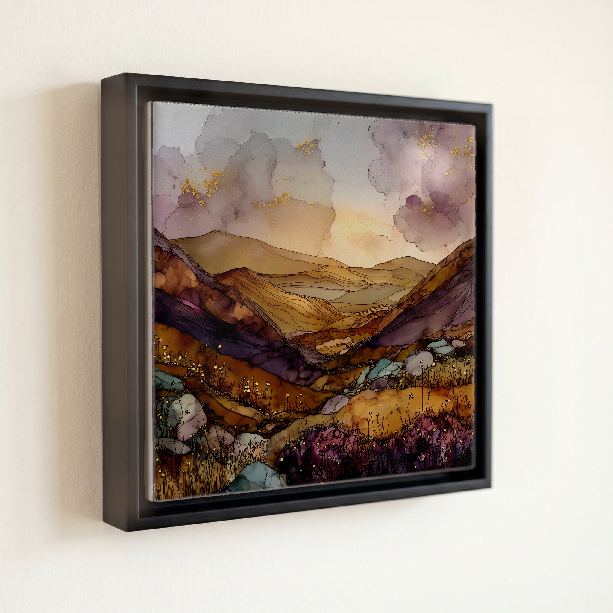
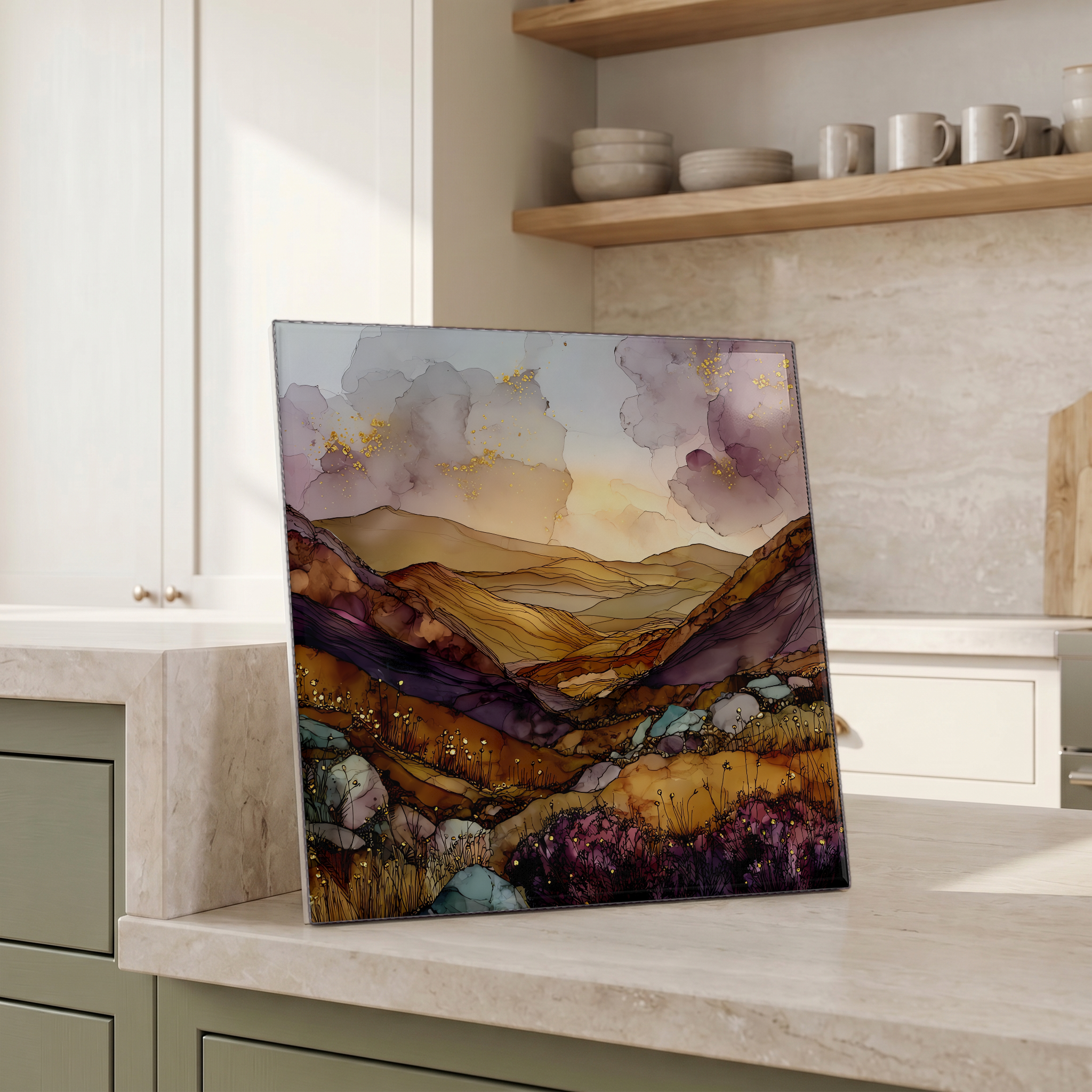
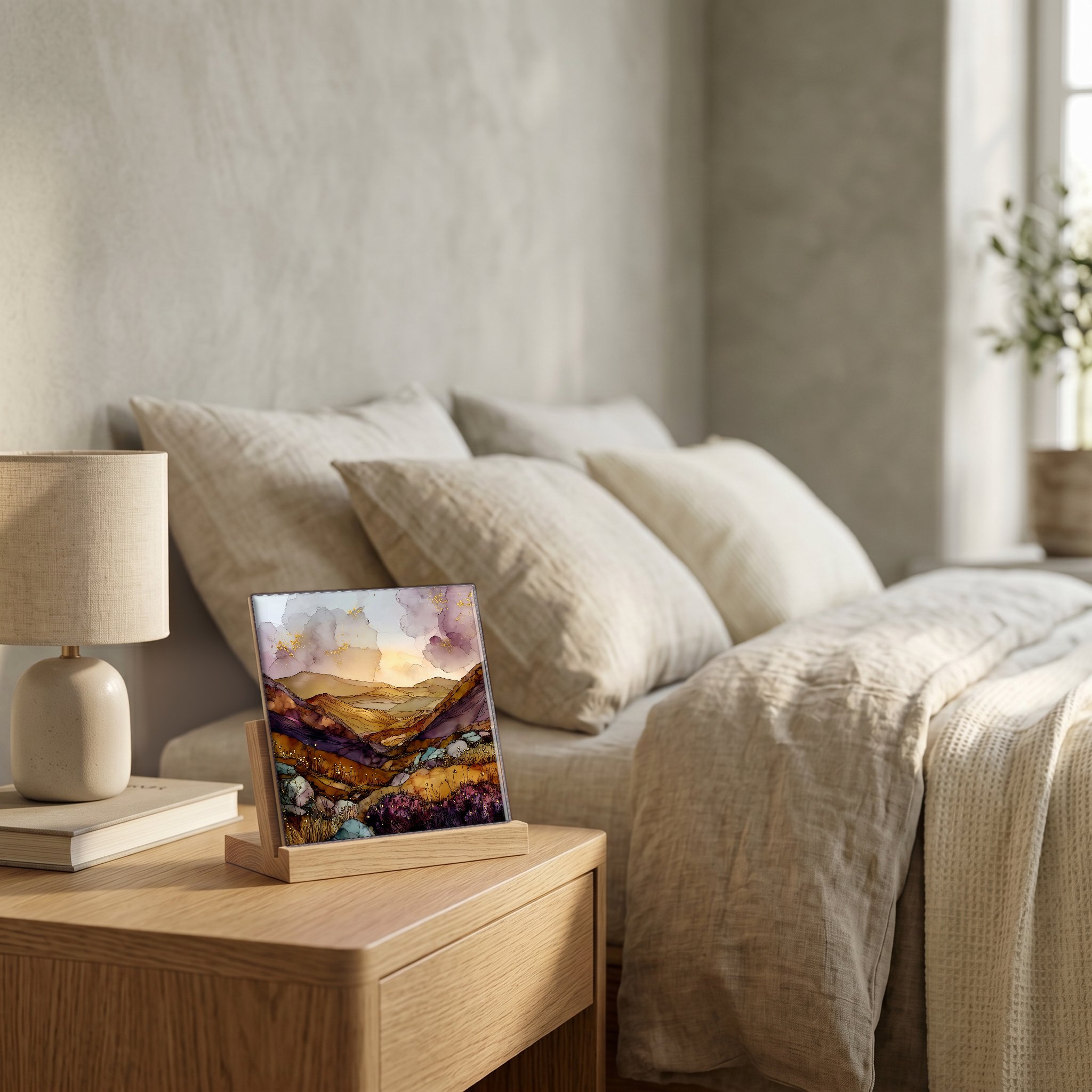
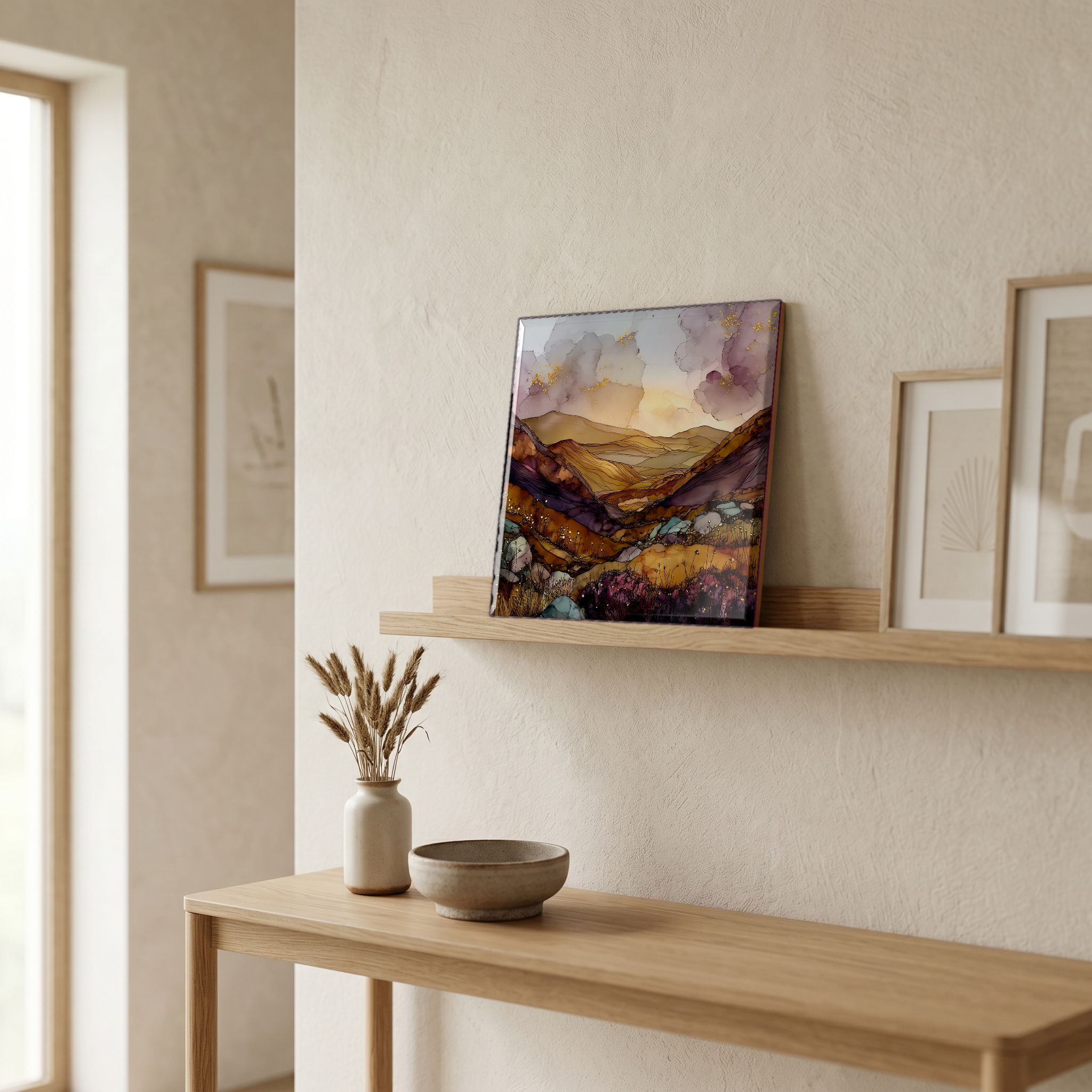
Sperrin Mountains, on ceramic.
Each tile is finished by hand in our Knoxville studio. Artwork is slowly infused into the ceramic surface under high heat and pressure, and rests beneath a thin glossy finish. The colour lives in the surface, not on top of it.
Pick any four 4-inch tiles — National Parks you've been to, a Smokies set, the four seasons of one place. $ for a set of , cork-backed, ready to live on the table.

Each tile ships in a kraft box, tied with cream ribbon, with a handwritten note from the studio if you'd like to add one.
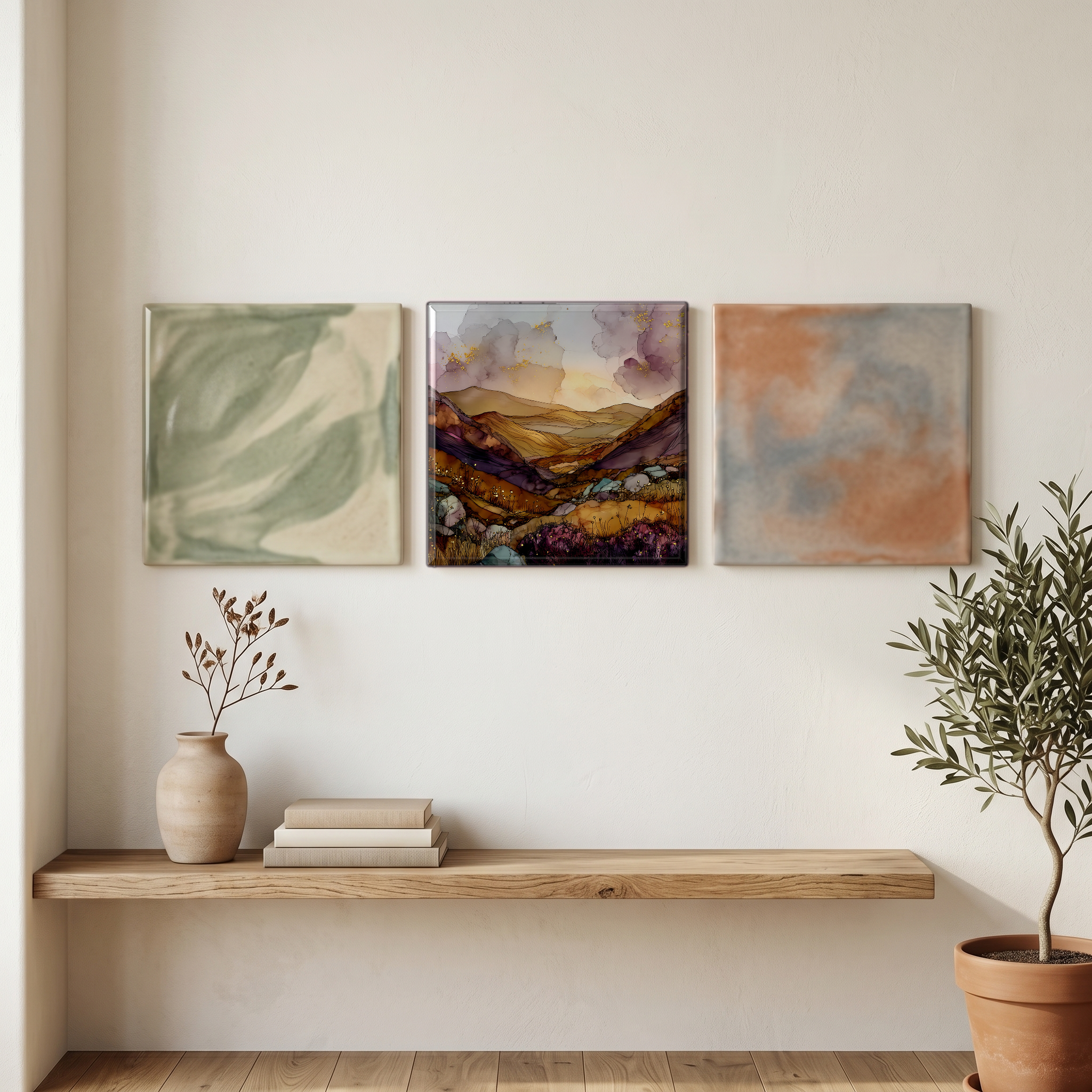
Three or five different vistas, hung together — a chapter of places you've been, or want to go.
The place, in three passes.
The Sperrins are one of Northern Ireland's largest upland ranges, lying across counties Tyrone and Londonderry. The range stretches roughly 65 kilometres from west to east, from Strabane to the River Bann. The highest summit is Sawel Mountain at 678 metres, on the Tyrone-Londonderry boundary. The Sperrins were designated an Area of Outstanding Natural Beauty in 1968, with the protected area covering more than 1,100 square kilometres of upland and adjacent valleys. The Glenshane Pass cuts through the eastern end, carrying the A6 between Belfast and Derry. The Glenelly, Owenkillew, and Owenreagh are the three principal river valleys, draining south and west into the Foyle and Lough Neagh systems.
At Beaghmore on the south-eastern edge of the range, seven Bronze Age stone circles and twelve associated cairns were uncovered from blanket peat between 1945 and the early 1960s during turf-cutting. The complex dates to roughly 2000 to 1200 BC. The stones are local schist and quartzite, the same Dalradian metamorphic basement that gives the Sperrins their long, rounded skyline. Smaller monuments scatter the range: court tombs, cup-and-ring carvings, single standing stones. Gold sits in those rocks too. The Curraghinalt deposit, near Gortin in County Tyrone, is mapped as one of the highest-grade undeveloped gold reserves in Europe.
The Sperrins are among the most sparsely populated upland areas in Northern Ireland. Glenelly Valley runs east to west between Sawel and Dart, with only a thin scatter of farms along its length. In 2020 the OM Dark Sky Park at Davagh Forest, near Cookstown, was certified by DarkSky International as Northern Ireland's first International Dark Sky Park. The OM Observatory opened that same year, offering public stargazing and an exhibition linking Beaghmore's Bronze Age alignments to the night sky. Belfast and Derry are each roughly an hour by road from the spine of the range. Walkers on the upland routes can pass an afternoon without meeting another.